
What’s the best wayfinding solution for your shopping mall?
That is our recommendation for this use case, rather than a claim that one technology suits every mall. A small neighbourhood centre, a multi-wing shopping complex and a mall with a widely used loyalty app may need different combinations.
This guide compares five approaches: plain signage and directory boards, touchscreen kiosks, app-free QR web apps, native mobile applications, and Bluetooth beacon-based positioning.

First, distinguish a directory from directions
A directory answers “Where is the shop?” with a floor and lot number. Wayfinding helps answer “How do I get there from here?” with a route and usable guidance.
Live positioning adds another function: estimating where a visitor is as they move. A route can exist without continuous tracking. Likewise, displaying a tenant list on a digital screen does not automatically make it a routing system.
Research by Dogu and Erkip examined how mall layout, visibility, circulation and signage influence navigation. In that case study, visitors still wanted better help finding particular destinations, even though they generally considered the mall easy to navigate. This is a useful reminder to test real journeys, not just how attractive a directory looks. [1: Shopping-mall wayfinding study]
Mall wayfinding options compared
Signs, kiosks and apps are visitor interfaces. Beacons are positioning infrastructure that can support an interface. They are included here because operators often encounter them in proposals, but they are not a complete substitute for a map and routing system.
Practical comparison; capabilities and costs depend on the proposed implementation.
Approach | Visitor experience | Best fit | Main limitation or cost driver |
Plain signage and directory boards | Read a map, list or directional sign; no phone required. | Basic orientation and a permanent navigation foundation. | Visitors interpret their own route; printed tenant information needs physical updates. |
Touchscreen kiosks | Search and view directions at a shared screen. | Prominent entrances, information points and visitors without usable phones. | Hardware, installation, power, upkeep and placement; directions stay at the screen unless a handoff is provided. |
App-free QR web app | Scan a code and open directions in a browser. | Casual visitors who want directions on their own phones. | Needs a usable phone and usually connectivity; a QR scan alone does not track movement. |
Native mobile application | Install or open the mall’s app. | Malls with an active app audience and broader loyalty or service functions. | Installation for new users, platform updates and app support; live positioning requires a supporting system. |
Bluetooth beacon-based positioning | A compatible app or integrated platform estimates location from signals. | Projects requiring continuous location awareness. | Installation, calibration, device compatibility, permissions and infrastructure maintenance. |
Technical examples supporting this comparison: QR entry points [2], kiosks and mobile handoff [3], a Malaysian mall app [4], and Bluetooth positioning [5].
1. Plain signage and directory boards
Printed floor maps, tenant lists and directional signs give visitors information without requiring a device, mobile data or software interaction. They remain valuable for identifying floors, lifts, washrooms and major destinations.
The limitation is the work left to the visitor. Finding a shop on a map does not necessarily explain the correct corridor or floor connection. Physical tenant listings also need updating when shops relocate.
Our recommendation: retain well-placed signs as the foundation. Add digital assistance where visitors need to search among many destinations or follow a more complicated route. A useful design review starts at entrances, junctions and floor transitions.
2. Touchscreen wayfinding kiosks
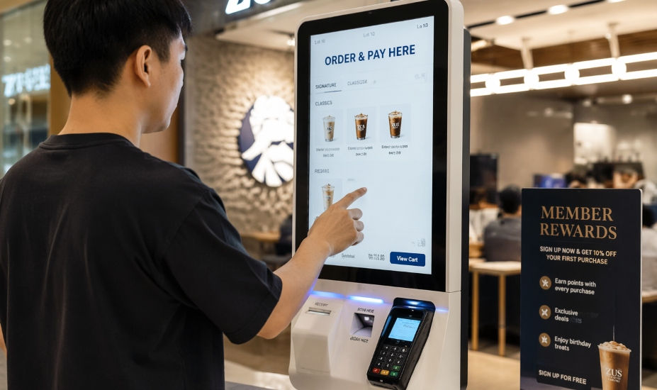
A touchscreen kiosk offers a visible place to search for a tenant and view a route from a known location. It is useful when visitors prefer a larger display or cannot use their own phones.
There are real deployments combining kiosks with mobile navigation. Mappedin’s Blanchardstown Centre case study describes interactive directories and a QR-based Mobile Pass feature for taking directions onto a phone. This demonstrates how the two interfaces can work together; it does not establish a guaranteed result for another mall. [3: Blanchardstown Centre case study]
When comparing proposals, account for the display, enclosure, installation, power, connectivity and maintenance. Also ask whether visitors can continue their journey on mobile after leaving the kiosk.
Best fit: important arrival points and malls that want an obvious shared navigation service alongside mobile access.
3. App-free QR scan web apps
An app-free wayfinding web app opens in a phone’s browser. A visitor scans a QR code, searches for a destination and follows the displayed route without installing a native application.
A location-specific QR code can tell the software which entrance or directory point the visitor is starting from. Mappedin’s documentation describes printed QR codes that open a map at the sign’s configured position. That is different from a generic QR linking to a homepage or PDF. [2: Location-specific QR documentation]
For malls, the practical advantages are:
No installation step: occasional visitors can access directions through their browser.
Directions travel with the visitor: the map remains on their phone as they walk.
More entry points without a screen at each one: printed QR signs can be placed at suitable locations.
Manageable content: a CMS-based implementation lets authorised staff update tenant information without reprinting every digital listing.
There are still deployment costs: floorplan digitisation, route configuration, hosting, support and QR signage. Check mobile reception, page loading and QR visibility on site. Keep alternatives for people without a usable phone.
Best fit: malls seeking browser-based directions for casual visitors, with the option to add kiosks.
4. Native mobile applications
A native app makes sense when navigation belongs within a broader service that shoppers already use. Loyalty rewards, parking and promotions can give visitors reasons to return to the app beyond finding a single store.
In Malaysia, Sunway Pyramid’s official Sunway Malls App page promotes real-time in-mall navigation alongside rewards, promotions and smart parking. It is a relevant example of navigation within a larger mall experience. [4: Sunway Malls App]
For someone who does not have the app, installation adds a step before navigation. Operators also need to maintain the application across supported operating systems. An installed app does not automatically provide accurate indoor positioning: that capability must be designed and tested separately.
Best fit: malls with an established app audience or a clear strategy for ongoing customer engagement. App-free access can still serve visitors who have not installed it.
5. Bluetooth beacons and indoor positioning
Bluetooth Low Energy beacons transmit signals from known locations. In a typical beacon-based indoor positioning system, compatible software on the visitor’s phone uses those signals to estimate location. Bluetooth SIG describes this architecture for indoor wayfinding, including shopping malls. [5: Bluetooth SIG explanation]
The benefit is location awareness while walking, when supported by the complete system. Beacons still need maps, route data and a visitor interface; they do not generate useful directions by themselves.
Infrastructure needs planning. Situm’s guidance explains how placement and configuration influence signal coverage, stability and battery life. Its maintenance documentation also covers depleted batteries and relocated infrastructure. Ask suppliers to demonstrate performance across your floors and supported devices. [6: Beacon deployment] [7: Infrastructure maintenance]
Best fit: malls with a defined need for continuous positioning and the resources to maintain the proposed system. Confirm the app/browser requirements and permissions for the exact implementation.
Does QR wayfinding provide a moving “you are here” dot?
Not from the QR code alone. A code tied to a sign identifies that starting point when scanned. Continuous movement tracking requires an additional positioning capability. If the visitor takes a different path, the system needs a way to establish their new position before it can reliably reroute them.
Do not assume that app-free always means no live positioning, either. Some suppliers support browser-based positioning subject to venue setup and device requirements. Mappedin documents one such implementation using Apple Indoor Positioning, including mapping, surveying and testing. [8: Browser-based positioning]
Ask a precise question: “Does this proposal provide directions from a selected or scanned location, or does it continuously estimate my position while I walk?”
How should your mall choose?
Our suggested starting point is clear physical signage plus app-free QR wayfinding. Add kiosks at locations where a shared screen solves a visitor need. Consider a native app or live positioning when those capabilities support a defined use case.
Before choosing a supplier, test:
Real routes: try an entrance-to-store journey, a journey between floors, and a route to an amenity such as a surau or washroom.
Map accuracy: confirm public entrances, shop access points, floor connections and restricted areas.
Accessibility: check legibility, contrast, clear controls and assistive-technology support. W3C provides relevant digital accessibility principles. Separately, verify that any step-free routes reflect real, usable lifts and access paths. [9: W3C guidance]
Day-to-day updates: establish who changes tenant details and who handles structural map or routing changes.
Total cost: compare mapping, software, hardware, signage, maintenance and future change fees across the same scope.
For a pilot, measure whether first-time visitors can reach selected destinations without help. Record completion time, wrong turns and feedback. Usage counts show adoption; they do not, on their own, prove visitors arrived or that tenant sales increased.
Where SP Wayfinder fits
SP Wayfinder is Southpaw’s indoor wayfinding solution for visitors who want to scan a QR code and get directions to a destination. It also supports kiosk mode, allowing malls to offer touchscreen access where required.
Its CMS lets the management team maintain directory data and view usage insights. Each client deployment requires floorplan digitisation and route setup for the actual property.
This makes SP Wayfinder an option for a mall that wants to begin with app-free mobile wayfinding and include kiosks in its deployment. The proposed scope should identify the floors, destinations, QR starting points, kiosk requirements and ongoing update responsibilities.
Explore Southpaw’s broader shopping mall signage and digital directory solutions, or try the SP Wayfinder demonstration. The demo uses a fictional mall; it is not presented as a customer deployment.
Planning a wayfinding upgrade? Share your mall’s floor count, available floorplans and current directory setup with Southpaw. We can discuss a suitable QR and kiosk deployment and the work required to map your venue.
Sources Dogu, U. and Erkip, F. (2000). Spatial Factors Affecting Wayfinding and Orientation: A Case Study in a Shopping Mall. Environment and Behavior, 32(6), 731–755. DOI: 10.1177/00139160021972775. Public abstract consulted.
Mappedin. Getting Started with Start From Here. Product documentation on QR codes and configured starting locations.
Mappedin. Blanchardstown Centre case study. Supplier account of digital directories and Mobile Pass.
Sunway Pyramid. Sunway Malls App. Mall operator’s description of navigation and other app functions.
Bluetooth SIG. Bluetooth technology is getting precise with positioning systems. Explanation of Bluetooth indoor positioning architecture.
Situm. How to place and configure beacons. Deployment documentation.
Situm. Infrastructure panel. Infrastructure monitoring and maintenance documentation.
Mappedin. What is Blue dot? Browser-based positioning and venue setup requirements.
W3C Web Accessibility Initiative. Accessibility Principles. Digital accessibility guidance.
Southpaw. Shopping Mall Signage & Digital Mall Directory with QR Code Wayfinding. Company overview of related solutions; this broader page also covers SP Signage.
Southpaw. SP Wayfinder demonstration. Fictional demonstration venue.


Comments